- Titel: Train Sim World 3
- Releasedatum:
- Ontwikkelaar:
- Uitgever:
Information about Train Sim World 3 is nog steeds onvolledig. Help ons alstublieft de details van het spel hiermee in te vullen contactformulier.
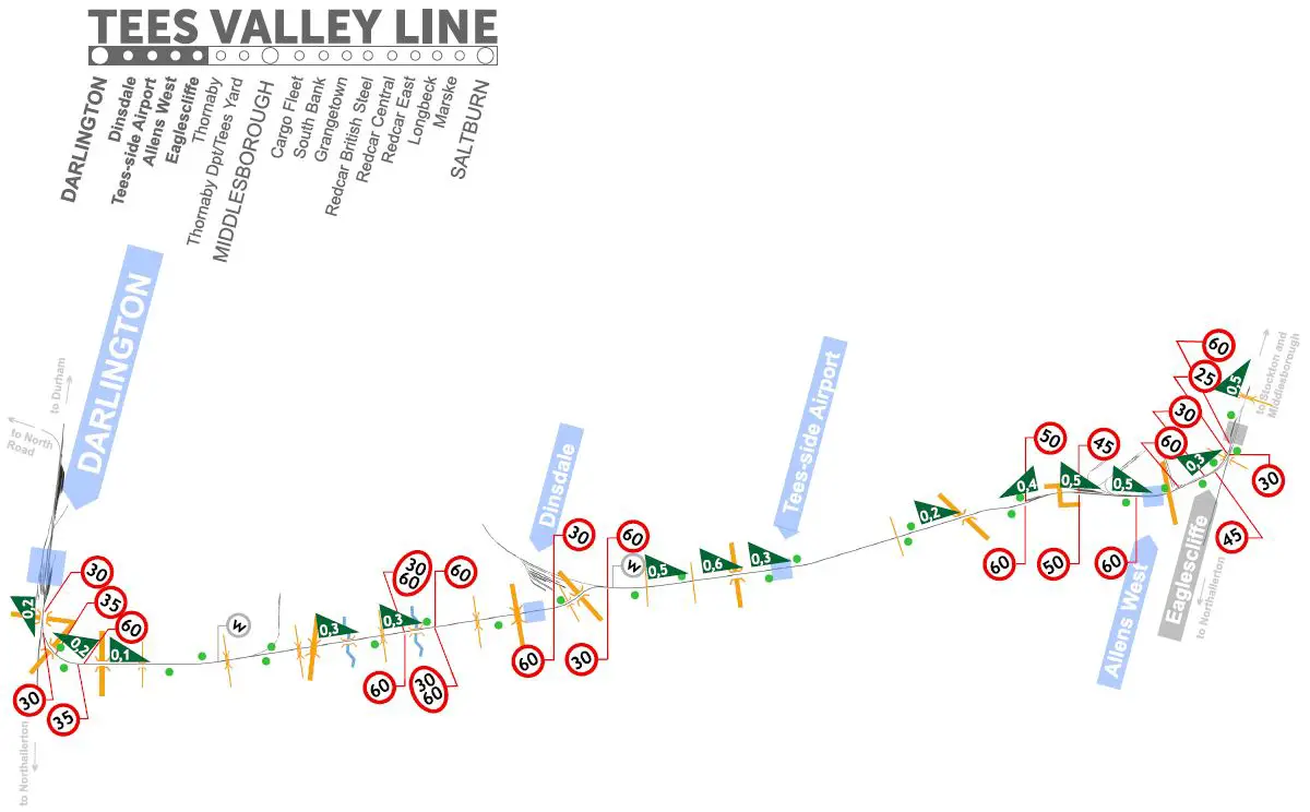
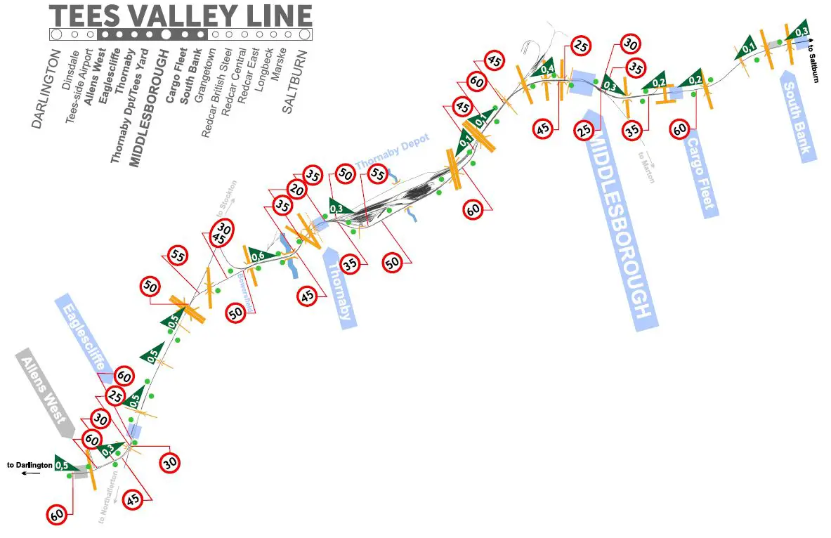
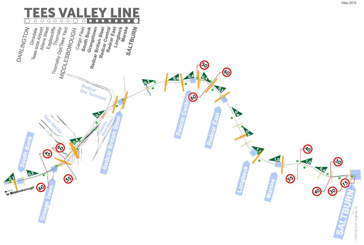
For those who like the TEES VALLEY LINE, I have prepared a precise map indicating all speed limits, uphill and downhill slopes, and characteristic elements in the field. I hope it will be useful, especially for realistic driving, without HUD, hints, and assistance.
About
The diagram shows the route, with the marking of the most important elements allowing for correct passage and orientation in the field.
Speed limits are marked in red in the diagram. They are inclined, depending on the direction they refer to. On some signs, there are two numbers – upper and lower. The upper – smaller – applies to the restriction for freight trains. Lower – bigger – applies to passenger trains. I marked the semaphores in green. The map shows all road crossings, bridges, and viaducts. A gray mark with the letter “w” means the signal must be used. The ascents and descents of the terrain are marked with a green triangle, slanted in the appropriate way. The numbers on the tile corresponding to the ascent and descent values in the game’s HUD.
The maps below can be downloaded as a higher-quality PDF file for self-printing.
Darlington – Eaglescliffe
The first section of the route is relatively simple and fast. Be especially careful in the Eaglescliffe area as there are quite a few speed limits.
Eaglescliffe – South Bank
It’s a challenging and varied section with lots of speed limits and traffic lights. In the middle is Thornaby Depot.
South Bank – Saltburn
Interesting episode. There are quite a few branching tracks in the Grange Town – Redcar area to nearby works. But from Redcar to Saltburn the road is straight, easy and fun.
Dat is alles wat we vandaag hiervoor delen Train Sim World 3 gids. Deze handleiding is oorspronkelijk gemaakt en geschreven door vitas. Voor het geval we er niet in slagen deze handleiding bij te werken, U kunt de laatste update vinden door dit te volgen link.