- 제목: SIM 세계를 훈련시킵니다 3
- 출시일:
- 개발자:
- 발행자:
기차 SIM 세계에 대한 정보 3 아직 불완전하다. 이것을 사용하여 게임의 세부 정보를 입력할 수 있도록 도와주세요. 문의 양식.
For those who like the TEES VALLEY LINE, I have prepared a precise map indicating all speed limits, uphill and downhill slopes, and characteristic elements in the field. I hope it will be useful, especially for realistic driving, without HUD, 힌트, and assistance.
에 대한
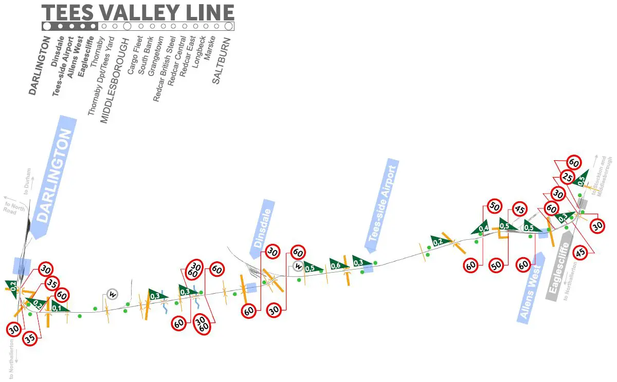
The diagram shows the route, with the marking of the most important elements allowing for correct passage and orientation in the field.
Speed limits are marked in red in the diagram. They are inclined, depending on the direction they refer to. On some signs, there are two numbers – upper and lower. The upper – smaller – applies to the restriction for freight trains. 낮추다 – bigger – applies to passenger trains. I marked the semaphores in green. The map shows all road crossings, bridges, and viaducts. A gray mark with the letter “w” means the signal must be used. The ascents and descents of the terrain are marked with a green triangle, slanted in the appropriate way. The numbers on the tile corresponding to the ascent and descent values in the game’s HUD.
The maps below can be downloaded as a higher-quality PDF file for self-printing.
Darlington – Eaglescliffe
The first section of the route is relatively simple and fast. Be especially careful in the Eaglescliffe area as there are quite a few speed limits.
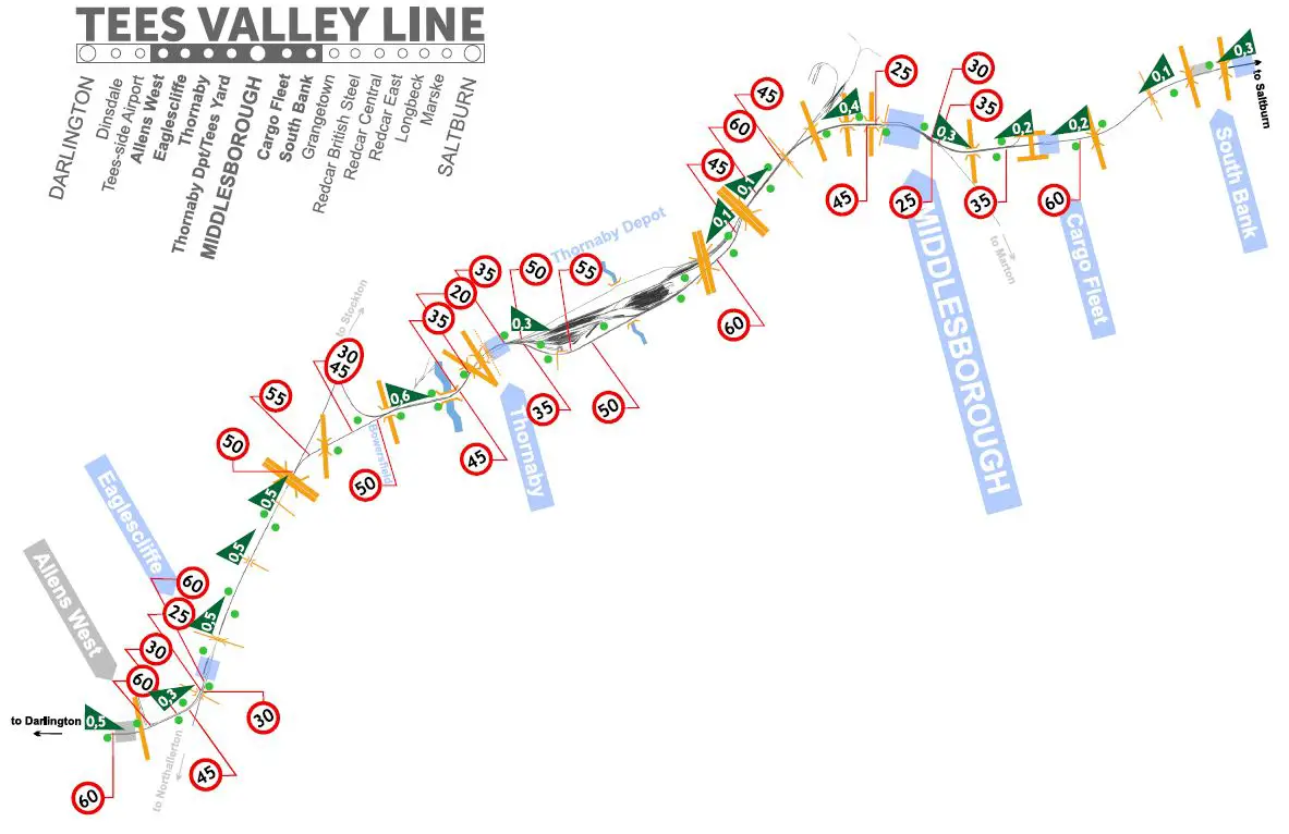
Eaglescliffe – South Bank
It’s a challenging and varied section with lots of speed limits and traffic lights. In the middle is Thornaby Depot.
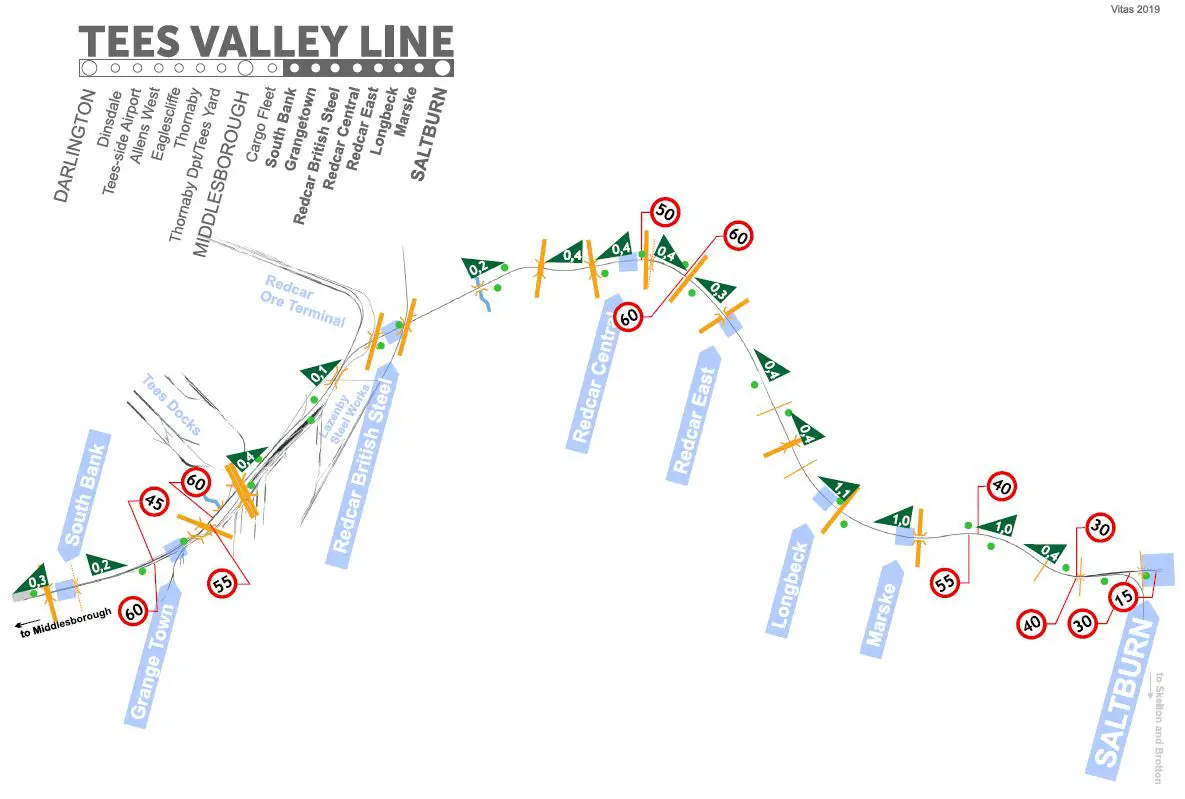
South Bank – Saltburn
Interesting episode. There are quite a few branching tracks in the Grange Town – Redcar area to nearby works. But from Redcar to Saltburn the road is straight, easy and fun.
이것이 오늘 우리가 공유하는 모든 것입니다. SIM 세계를 훈련시킵니다 3 가이드. 이 가이드는 원래 작성자가 작성하고 작성했습니다. vitas. 이 가이드를 업데이트하지 못한 경우, 다음을 수행하여 최신 업데이트를 찾을 수 있습니다. 링크.